Applications of GIS for Reservoir Sediment Study
Tiao J. Chang[1], Travis D. Bayes[2], and Scott McKeever[3]
Abstract
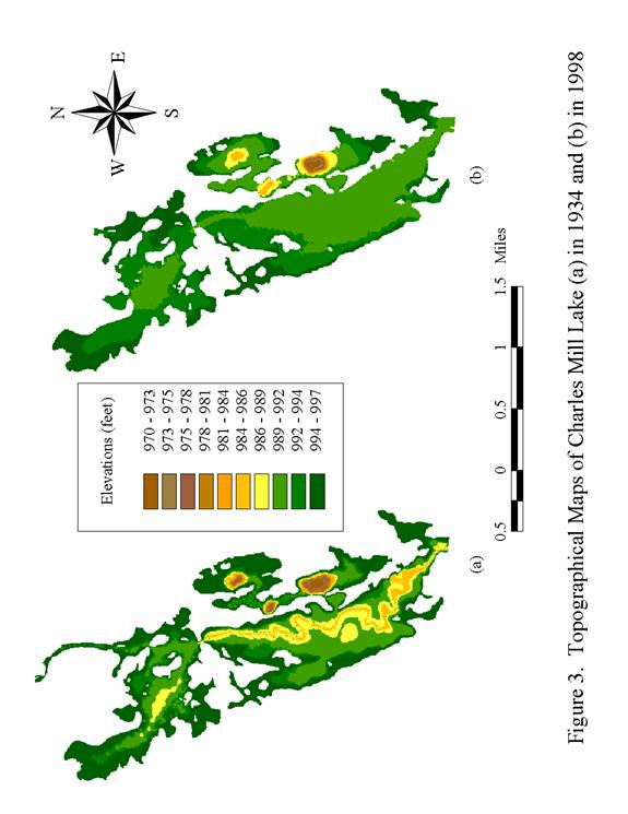
Dredging has been the most common means to maintain continuing uses of aging reservoirs. Investigating spatial distribution of sediment deposits using GIS, this study gathered the information for dredging so that materials dredged could be properly used to form wetlands in the same reservoir. Based on the recent survey and the original topographical maps of the studied reservoir, an image of sediments using GIS was developed to show variations of deposits in the reservoir. Then, sixty locations were selected to geographically represent the lake for sampling. A gravity corer, sixty centimeters long and eight centimeters in diameter, was used to collect sediment samples. Each sample of sediment deposit was then bagged and marked with its geographical location using a global positioning system and physical landmarks in conjunction with a detailed map. Samples were dried and analyzed by mechanical sieve analysis to develop a particle-size distribution curve. Grain sizes of sediment deposits at sampling locations, assumed to be geographically referenced variables, were spatially interpolated to form a regional distribution. The analysis of sediment grain sizes and texture classification resulted in grids of raster-based values that can be expressed by spatial images. The analyzed results were used to develop the guidance for future dredging programs.